Sunday, April 2, 2023

3/30 - 4/2 Camping and Off-Roading in Moab on the Rogue Overland Winter Expedition

The gang all lined up
It was that time of year again for the Rogue Overland Expedition 2023! This looked to be the biggest year yet with 39 trucks in attendance. The guys at Rogue planned this trip to be out in Moab, although thankfully on different trails than we did just a few weeks prior. Fresh off our last trip, Nina decided that one visit to Moab a month was sufficient so her and Winston stayed home for this one. The plan was to meet up on the trailhead of the 7 Mile Rim at 0730 on Thursday morning so Lou and I decided to split a hotel room Wednesday night after the 7 hour drive so we could arrive fresh in the morning to start the weekend! 

Day 0 - Wednesday
Wednesday was not an exciting day as I started work at 4:00am that day, worked, packed up and crushed the 7 hour drive out. As luck would have it, I watched Lou roll into the hotel parking lot from across the street after filling up the gas tank so we arrived within mere seconds of each other. We got our room and looked to get dinner somewhere in Moab. However, due to the late time we arrived, our best option was Wendy's so I got to ride shotgun in the Jeep as we hit up the drive through. We went to bed for an early wake up the next day.

Day 1 - Thursday
Bruce the Bronco starting
Thursday was our first real day on the Expedition and we woke up excited! We munched down on the free hotel breakfast and made the short drive to the trail head arriving a few minutes early so we could say hi to all our friends we haven't seen in a while. After airing down, Nick gave his typical welcome brief in between gusts of dust as the weather was already getting cold and windy. Once complete, it was off on our first trail - the 7 Mile Rim. 

The group on 7 mile rimThe biggest obstacle on this trip wasn't a rock or a trail but rather the size of the group. With a group of 39, it was difficult to get things moving but the guys at Rogue had a plan! They split us all into 4 squadrons each with a squadron leader so we could move in smaller groups. Lou, Mike and I were all in the blue squadron which was a great group even though I would have preferred the red squadron to match Bruce the Bronco's red color. 

Uranium Arch sign
Once we all got rolling, the 7 Mile Rim took us up and out of the Moab valley below and into the mountains offering great views of the other squadrons below (our squadron was first). Our first stopping point was the Uranium Arch. However, during the climb out, the weather had gone from cold and windy to cloudy and snowy as flurries were starting to fall. This made visiting the Uranium Arch really unique since it's rare to see snow falling over the red rock desert landscape let alone spiraling under an arch.


All 39 trucks at Merrimac Butte
After a quick stop and an apple break, we continued on ahead enjoying the snow. Our pace was a bit slower since the rock was slick but we made it to lunch right on time just as the sun started coming out. The guys at Rogue picked the Merrimac Butte since it was a large area to give everyone plenty of space. Bruce the Bronco and Juniper the Jeep had front row seats! 

View of Wipeout Hill
Next was the big obstacle of both the day and of the weekend called Wipeout Hill and was the main attraction of the 7 Mile Rim trail. This obstacle features a rugged descent into the 'wipeout' portion where, rumor has it, vehicles wipe out quite often ascending. Thankfully, we were descending. The Bronco registered a 33-degree descent at the steepest portion of the obstacle but made it through with little issue. In fact, everyone in our group made it down with only minor rubbing and maybe a few squished exhaust tips. Unfortunately, neither Lou nor I took any photos of the obstacle so you'll just have to wait for the Rogue Overland official YouTube video for footage! 

Bottom of Wipeout Hill
Following a success descent on Wipeout Hill, we were in for an unexpected treat as we were exiting the trail. We passed a Jeep event where they were testing out future concept Jeeps both gas and electric. Pretty cool! 

Then, we quickly drove through town to get to our next trailhead - Hurrah Pass. This trail takes us to camp that night at the Base Camp Adventure Lodge, which is on the trail, for a fancy catered dinner and raffle! 

Base Camp Adventure Lodge

Rocky in the roof top tent
After quickly setting up camp, our friends Mike and Lizzy's dog Rocky got into a tiff with another dog from camp and was bitten on the ankle which punctured it. He seemed okay initially but Mike was concerned about it getting infected especially if Rocky was running around in the dirt. We decided to quickly get some catered dinner, pack up, and take our two vehicles back to town to find an emergency vet. I found out later that I won the AT Overland Equipment water Rotopax mount which is something I will put to good use on the next trip.

Dramatic views of Moab
During the drive out, we cut the time in half  in an attempt to beat sunset which we did. Since we didn't have service, Mike and Lizzy used their Garmin inReach to text Nina who was back at home asking her to look up local vets. Nina found an emergency vet on call in town and was able to relay the information back to them so we had a game plan once we hit pavement. Once we arrived, the vet shaved his ankle, cleaned it out, gave Rocky three staples which he took like a champ, and wrapped it for protection. After taking the first dose of his new antibiotic, Rocky was good to go! Once Rocky was taken care of, we decided not to run the trail at night so we camped at a local KOA campground. 

Day 2 - Friday
Mike and I at camp
Friday morning was an easy morning for us. We knew the group wasn't rolling out of camp until 0800 and we estimated it would take them an hour and half to get back to pavement (it took us 46 minutes to complete it the night before). After sleeping in, Mike decided to take advantage of our free time and take a shower. I chose not to since I woke up in a hotel just the day prior. Once we were cleaned up, we meet the group at the trailhead. There was mild confusion about the meet up point and time since there was limited cell phone service. I felt the root cause was that I didn't have any satellite device so I remedied that by buying Beardo's Garmin inReach so I'll be better prepared for next time! 

Manti La Sal National Forest welcome sign
We met up with the group around 1000 which was right what we estimated. From there, the Rogue guys made sure Rocky was good. It was clear that everyone felt bad about what had happened the evening prior even though it was an accident. Once we joined back up, we pushed for gas before driving up the La Sal Loop in Manti-La Sal National Forest. This loop was higher elevation so still snow covered in some areas. We stopped for lunch at a large turnout with a great view of the surrounding area! 

Moab valley covered in snow

Snowfall on the mountain into Onion Creek
Post lunch, it was a short drive to our next trail which is the backside of Onion Creek; however, the year's abnormal heavy snowfall caused the trail to still have feet of snow on it despite being a little later in the year. We attempted to break our way through by sending one of the heavier full size trucks through while shoveling but it quickly bogged down and was difficult to recover. I personally think the lighter-yet-still-decent-horsepower Bronco could have made it but we didn't know how many deep snow pockets existed so it wasn't worth continuing to try. We were defeated by the snowy mountain just like Gandalf at the pass of Caradhas. 

The guys at Rogue rapidly formed a back up plan - instead of wheeling into Onion Creek, we would just take pavement to the trailhead for it and run the trail that way. Although it did take awhile to turn around such a large group, we were all moving that way in no time! 

Bronco in Onion Creek
The weather was finally getting a little warmer so I decided to take the top down at the start of the trailhead and I'm glad I did - Onion Creek quickly became the highlight of the trip for me. Although it was a short trail, it took us along the Onion Creek in the canyon between two towering rock faces with plenty of water crossings. Although it wasn't a technical trail, we couldn't get going too fast but just fast enough to make a splash as we hit the river. I ended up getting too close behind Lou and the Bronco interior got a little wet but no biggie. 

Before the uphill out of Onion Creek, there was a last river crossing which was very high from all the recent snow melt. It ended up being a blessing in disguise that we had to turn around on the mountain pass since we would have ended up turning around once we arrived at the river crossing. 

Bruce at Entanda Bluffs
After Onion Creek, we headed out to camp at the Entanda Bluffs. This was a big area wide enough for the entire group which worked out nicely. Starting the night prior, I had started to sleep in the Bronco since I was too lazy to set up the tent single person and tonight was no different which gave me plenty of time for other activities. This was my first night at camp so it was great to walk around and catch up with the gang and meet some new faces. 

Day 3 - Saturday
Camp Saturday morning
We woke up refreshed and ready for the next event on Saturday knowing this would be our last full day. After breaking camp, we drove the few short miles back out and hit some highway miles going west. We drove for about an hour before arriving at our destination which is an old missile testing facility called Area 52. Although it had been abandoned many years ago, the building structures and general layout remained the same. It was interesting to see how government buildings were set up with large server racks and built in space in the ceiling for wiring. 

Green River Valley
We stayed for about an hour and a half before getting gas then pushing towards our last trail which I'm going to call the Green River trail since I don't know the actual name of it. This trail followed the Green River (which was actually more brown like most desert rivers rather than green) and had a few fun obstacles for us along the way. This was the first day where it actually got a little warm so we all started turning our A/C on. After moseying through the trail, we ended up at a bend in the river and made camp there. 

Moscow Mules over Green River
Our camp was a cool unique spot that was broken up into three different levels with camping options on each. A majority of the folks chose to stay on the ridgeline but we chose to camp down near the river since I wanted to stay out of the wind and be a little closer to the flowing water. I dared Mike, Lizzy or Lou to jump in the river but none of them wanted to. Shocking! I went as far as having a drink by the river but I wasn't jumping in either.


The huskies in the shade
Once at camp, Mike gave Rocky a nice bone to chew on which he enjoyed despite his ankle still being wrapped. His injury seemed not to phase him but he was still getting fed his antibiotic everyday just to make sure it didn't get infected while Mike and Lizzy were changing his wrap everyday as well. We stayed down at our lower ridge line for most of the night since it was pretty windy up top but we all turned in a little early since it was a full day.

Day 4 - Sunday
We slept in a little bit the next day but Lou and I decided to split off to start heading home. I think us going to Moab just three weeks prior made us ready to go so we could unpack before the start of the work week. Mike and Lizzy decided to stay with the group and drive further away from home and check out Capitol Reef which was the agenda for that day. They said it was a great day so we added Capitol Reef to our to-do list time permitting on our next Moab/Colorado push. We got home around 5PM with time to unpack and start laundry. 

Overall, it was another great Rogue Overland trip and looking forward to the next one! 

Files:

Monday, February 27, 2023

2/24 - 2/27 Camping and Off-Roading the White Rim Trail

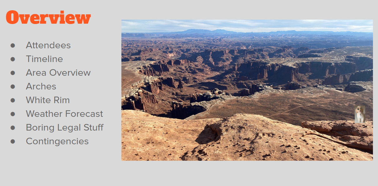
PowerPoint overview slide
The White Rim Trail. I don't even know how many times I saved some random post on Instagram about this trail so enough is enough, time to book the trip! I hopped on the recreation.gov website to get a reservation and was quickly surprised at how few openings were available even months in advance. Thankfully, after some quick googling, I picked two potential weekends in February where the average weather wasn't too cold and looked doable. Then, I realized the permits issued maxed out at three vehicles so I had to pick who to invite carefully. I put together a preliminary itinerary and PowerPoint, emailed it out and started putting together the trip. Unfortunately, not everyone was able to make the same weekend so I had to pick the best weekend which meant our friends Blake and Faith couldn't attend. I was disappointed that they couldn't make it, but we will plan another trip! 

Day 1 - Friday
The plan was to depart our respective states (Nevada, Arizona and Colorado) and meet at the Texaco Gas Station in Moab at 1645 local time, gas up and head to camp. It was about an eight-hour drive for each of us. Lou/Pa and Nina/I arrived a little early but Mike and Lizzy were delayed due to a winter storm over the Colorado highway mountain pass, so we elected to push to camp without them so we could scout out the campsite in daylight with the intent for them to catch up when they arrived. 

The plan for camp was to go to a dispersed camp site I identified on Google Earth that wasn't far away from both the gas station and the start of the White Rim trail so I figured it would be a good spot. The short off road trail to get to it was called Long Canyon Road then Pucker Pass. My initial research made it seem like it wasn't that bad. 

Pucker Pass trail covered in snow and ice
So Lou and I headed out to start the trail and quickly realized the shady parts of the trail were covered in snow. The snow was only 2-3 inches thick so I didn't think much of it as I had off-roaded in the snow before. What I failed to realize was how heavy the snow was. We think it had snowed more than a few inches previously then warmed up causing much of the snow to melt and leaving behind a heavy, dense snow layer. Unbeknownst to me at the time, the snow had bunched up in the tread of my tires right as I approached Pucker Pass and filled the lugs in completely turning my once MT tires into racing slicks. Upon hitting a small incline underneath the rock overhang of Pucker Pass, the Bronco started sliding backwards; I immediately hit the brakes to stop the acceleration with no success, the parking brake was also no help, so I shifted back into drive and tried to drive forward to stop the rearward sliding - also with no success. Thankfully, I was the trail leader so Nina radioed to Lou behind me in his Jeep, who still had traction, to rear end us to stop our sliding since we were quickly approaching a sharp bend in the road before a drop off. Although it wasn't a hard hit, it did stop our slide and gave us an opportunity to stop and reassess our plan. We elected to air down further, turn around, meet up with Mike and Lizzy back at the Texaco and come up with a new plan as a group.

The trail down was a little slick but not as bad as expected so we quickly started our way back. We reached out to them once we had service to ensure they wouldn't follow us up the pass. After filling them on the situation, they picked a local camp spot and we decided to camp there instead of pushing to a more dispersed area. 

Arches National Park entrance sign
Day 2 - Saturday
The plan for day 2 was a relaxing drive through Arches National Park to check out the Arch that inspired the Utah license plate - the Delicate Arch. We all slept in a little bit after a long work week, 8 hour drive out then an exciting evening the night prior so we arrived at Arches a little before lunch. 

Once we were at Arches, we started working our way over to the Delicate Arch parking area. Arches was a bigger national park than I thought which provided us with plenty of good views as we drove to the trailhead. Once there, we unloaded, packed up and headed out on foot!

Slipping on ice hiking to Delicate Arch
The trail was a pretty solid incline with an icy pass at the end. Nina and Pa didn’t want to risk the ice so they turned back a little early while the rest of us pushed to the arch. It was a heck of a view! Thankfully it was off season so wasn’t that crowded but even then, there were still crowds so we had to wait in line for our turn to have the arch. Once we got some decent photos, we headed back out, met up with Nina and Pa and decided as a group what we wanted to do for lunch. 

Delicate Arch in the winter

Bruce and Nina at camp
It was a little after 1PM and we were all pretty hungry so we decided to go to the Moab Brewery for a late lunch. Although it was a brewery, none of us ordered any beers so we can’t remark on their craft beers, but I can personally say their Moscow mules were very good!

After lunch, we went to a local spot for some ice cream to really top off our lunch. Well worth the extra stop! From there, we went to the Williams Bottom Campground right on the river which was a first come, first serve campground and were able to secure three campsites next to each other. I think we would have been hard pressed to get a spot had we been in peak season.

Sunset over camp

Nina waking up in the morning
Day 3 - Sunday
Day 3 was the big day - White Rim Trail day! I was very excited. Unfortunately for us, there was a winter storm that rolled in a few days before our arrival which closed the Shafer Trail entrance that we had planned to use. This wasn't a big deal though, it just meant we had to come in on the Potash Road which was a few extra miles. Since I knew it was going to be a full day of driving, we set an early departure time and rolled out early to seize the day! 

Thankfully, our camp site was fairly close to the start of Potash Road so we able to get a fast start. After airing down, it didn't take us long to realize the skies were looking a little dark and stormy. Although we no longer had cell phone service to check, I used my expert aviation knowledge and decided that we would be fine but we all agreed on abort criteria if the weather did turn nasty. 

Thelma and Louise Point
Once on the Potash, it didn't take long for us to come across the Thelma and Louise point made famous by the film, you guessed it, "Thelma & Louise". This viewpoint is not something we would have been able to see if the Shafer Trail entrance had been open so I guess the weather was a blessing in disguise, at least so far. 

Big rocks on White Rim Trail
Although we hadn't even officially started the White Rim trail, the scenery was already awesome with overlooks of the river on one side and big ole boulders and sweeping canyon walls on the other. We, of course, had to stop a get a picture showing how big some of the boulders were. Crazy to think these boulders were once on top of the canyon wall and had suddenly fallen to the canyon floor. I would hate to be standing there when that happened! 


The trucks on Potash Road
Once we finished the Potash Road entrance, we came to the junction of Potash Road, Shafer Trail and the White Rim Trail. It was just as the friendly Park Ranger described when I called earlier in the week - there would be a gate preventing us from accidentally turning onto Shafer, there would be a drop toilet and there would be a clear entrance to the White Rim. One glance at the sweeping, descending switchbacks of Shafer Trail covered in icy snow similar to what I encountered just two days before made me instantly thankful that the Canyonlands National Park Service regulated this trail so much since I'd hate to think what would have happened if we had attempted Shafer Trail in those conditions. After a short break and another look at the weather, we made the left turn and started our day's adventure already a little behind schedule knowing we had 75 miles to cover. 

Musselman Arch

We didn't get far before our next photo op, this time it was the Musselman Arch measuring at 187 feet long but only 5 feet thick at its thickest. We practiced our good Tread Lightly procedures and decided to not to walk across it but we did take some good photos and admire the area! The clouds were preventing us from seeing the far canyon wall which was a unique experience.

Airport campground on White Rim Trail
After the Musselman Arch, we had a bit of driving to do before lunch. The Park Service does a great job keeping drop toilets available and clean at each designated campsite so I wanted to push to the next campsite so that we had toilets available. The next one up was the Airport A, B and C areas. Supposedly the major rock formation in the area looks like an airport control tower but I'm not sure I saw it. Thankfully, there was no one at these campsites so we decided to stop and grab lunch. It was around this time that the weather had finally started to clear up a little bit offering us hope that we'd be somewhat warm at camp that night. 

Washer Woman Arch on White Rim trail

After lunch, it was only a few short miles before we stopped briefly at the next viewpoint - Washer Woman Arch. This arch looked exactly as it was called even from the great distance away that we were, however; we didn't have the luxury of staying long so we kept on pressing knowing that we were still a bit behind schedule. 


Climbing in mud on Murphy's Hogwash on white rim trail
As we continued, our next big obstacle was Murphy's Hogback which was the only real obstacle of the trail that I was concerned about. This section takes you from the canyon below up a narrow pass to the top of the mesa, passed the three campsites up there then back down to the canyon below. The way the sun was hitting the trail caused the climb to be very muddy instead of snowy so I put Bruce the Bronco in 4Lo, put both lockers on, ensured Nina had her seatbelt on and up we went. It was the kind of obstacle that you have to finish once you start. The mud was 4-6 inches deep in the thicker sections but the routs kept you on the trail as you slid back and forth trying to get traction. I was happy to have both lockers engaged for this as it kept my momentum up. All three vehicles made it to the landing before we stopped to take a look over Canyonlands. 

Views from the top of Murphy's Hogback

Icy descent from Murphy's hogback on white rim trail
We didn't pause for too long though since the wind was really blowing up here. The three campsites on top of the mesa would be great views but we all made mental notes not to get a permit to stay there due to the high winds. As we pressed on, we discovered that the backside was in shadows most of the day so instead of 4-6 inches of mud, it was a mixture of frozen ice and snow similar to what we encountered previously. I put it in park as we gathered to discuss options. 

Talking about our options
Mike volunteered to walk the length of the ice section on foot while the rest of us debated pressing forward or turning around and exiting the way we came avoiding this section all together. When Mike came back, he wasn't very confident in this section but thought that going down the icy descent was a better option than fighting the mud where we just came. We also discussed staying here overnight but decided that both hills would be more treacherous in the morning when the overnight freezing temperatures would make the ice worse so we shifted the conversation to figuring out how best to do this. 

The idea we came up with is sending myself in the Bronco down first winched to Lou in the Jeep at the top of the hill where he still had solid traction while strapped to Mike in the Tacoma for an anchor behind him. The plan was to have me test out the traction of the ice with the safety net of the winch line to stop my descent if I were to start sliding. Pa volunteered to be out in front spotting me in the Bronco as needed through the various sections and was a huge help both in terms of spotting but also in terms of emotional support. Both Lizzy and Nina stayed at top of the hill in case things went sideways. It ended up being just fine as we descended together as a team. Although in hindsight I do not think the winch line was necessary, we didn't know that at the time, and we wanted to err on the side of caution especially having a sketchy situation in recent memory. 

Backside of Murphy's Hogback
Once we got to the bottom of the turn where the sun could hit the trail, the ice turned into mud, although not as heavy as the mud on the uphill but enough to prove to Nina that Lou's MTs cleaned far better than my stock Sasquatch package tires did especially at slow wheel speed. We took a moment to unhook from each other, shifted into 4Hi and bombed it to camp hoping to beat the sunset. This was my first real time letting the Bronco suspension fully cycle as we crushed mileage racing to camp and I was pleasantly surprised by it. I do feel the bump stops engage a bit early but I was still able to get up around 40MPH with minor bumps pretty easily. 

Potato Bottom campsite at the end of white rim trail
Although we didn't beat the sunset, we were able to set up camp before the end of Civil Twilight. I secured the permit for camp at Potato Bottom A since it seemed removed from the B and C sites and it was a great spot. It was tucked into the valley enough that the winds weren't brutal and it was right along the river. For future trips, I'd secure both B and C for larger groups on two permits. We called it an early night so we could get an early start the next day. 

Day 4 - Monday
Views on White Rim Trail
Day 4 was the day we were all driving the ~8 hours home so we wanted to get an early start to finish the trail and hopefully be home at a decent hour. That is why I chose Potato Bottom for our campsite - it was as far as I thought we could get in one day so that our departure would be the shortest distance possible. After a quick breakfast, we packed up and got rolling early! 


Exiting on the Shafer trail of white rim trail
I think by the end of the White Rim, Nina was about done being off road and she thought we were almost done, and we were almost done. But, since we didn't descend on the Shafer entrance, she didn't realize we had a similar exit, only this one was up the Mineral Bottom trail. Unlike the Shafer, this one gets more sunlight so there were only a few patches of snow but it was still a twisty, gnarly climb out on the switchbacks. 

Once we finished that, it was just a groomed dirt road out that we made good time on. At the end, we all aired up, said our goodbyes and headed our different ways. We all were home by dinner after a great trip! 

Epic views of white rim trail

Overall, the White Rim was a great trail. I think we all agreed that you really need two nights on it to fully take in the trail so in the future, we would get a permit for the first night at one of the Airport camp sites then a second night at Potato Bottom. That would give us more time for photos and to explore a few of the hiking trails along the way. 

Files:

Thursday, November 17, 2022

11/5 Hiking Fletcher Peak, Mt Charleston, NV

Winston in the snow on Fletcher Peak
Next on our hiking list was tackling Fletcher Peak. We were at an advantage since Fletcher Peak and the Raintree trail are the same trail until a fork near the end. When we did Raintree trail last time, we took a right at the fork. This time, we just needed to take a left and we would be on the slightly longer and more uphill Fletcher Peak trail. So, Winston and I packed our bag, grabbed a few snacks and headed out to start up. This would be our first ascent of a 10,000-foot peak and I was excited. 

Not long up the trail, we discovered that the recent rain that Vegas received was snow up here at the higher altitude. Winston loves snow and he ate snow every chance he had. He chose to walk in snow whenever there was an opportunity. 

Views hiking Fletcher Peak
However, the snow was limited to patches on the backside of the ridge so as we continued, we broke out of that and back into the sun. The trail was well marked so Winston as our pathfinder and scout had no problem following the correct path as we climbed up the switchbacks towards the ridgeline. 

Once we were on the ridgeline, the trail opened up into sweeping overlooks of the surrounding areas. Thankfully, there was very little wind otherwise it would have been chilly on top of the ridgeline without any trees or scrubs for cover.

Winston looking out over the fletcher peak hike

Once we passed that, it was back up the next ridge towards Raintree. A few tenths of a mile short of Raintree was the fork to Fletcher Peak. This crossroads was not labeled, and the Fletcher Peak trail was much smaller and harder to see than the well-traveled Raintree trail. Thankfully, we had the Gaia tracks downloaded otherwise I think we may have walked right by it. 

Once we made the left, it was only 0.7 miles to the peak but it was a tough 0.7. It was steep instead of switchbacks that we were used to. Additionally, the terrain was all scree rock combined with some snow which made it very slippery. Once we pushed through that, we broke into a large landing that was obviously the peak. That meant it was lunch time! I had a Clif bar and Winston had his two cups of puppy chow. Winston also had some of my Clif bar if we are being honest. After we had our lunch, I made Winston pose for a pic at the summit. He wasn't impressed but he sat for it like a good boy. After our photo, we made a journal entry in the journal stored at the top of the summit. It was pretty cool to see all the other individuals who made the trek to the top. 

At the top of Fletcher Peak

After that, we took another good look at the views before heading back down the way we came up. Going down is always faster than going up but we had to be careful with our foot placement as the slippery scree was still a problem. Once we reached the fork, the scree wasn't a big deal anymore and we scurried on back to the car in record time. Winston slept in the car ride back and was fully energized when we returned to the house like it never even happened. All in all, the hike was 7.4 miles with 2,130 feet of climb taking us 3+58 hours. This was our first 10k peak and we have big plans to take on some other peaks with our new found confidence! 

Sunday, October 23, 2022

10/23 Hiking Gass Peak Overlooking Las Vegas

Gass Peak at sunset from the road
One of the hikes that we have wanted to do for a long time is Gass Peak. I drive past it everyday on my way to work and I've always wondered what the view of the city of Las Vegas looks like from there. So we decided to invite a few friends, grab Winston and make the 30 min drive to the trailhead. The hiking trailhead requires about 15 miles of easy off roading so we aired down Bruce and made the rest of the drive. The photo to the right is my view of Gass Peak from highway 95 on my drive to work. 

Winston on Gass peak trail
We picked a fairly chilly day to hike up Gass Peak. Although the temps were in the 50's, the wind was 30-35 knots so very gusty! The route was fairly straight forward, you just start in the parking lot and keep going until you get to the top. The trail was somewhat difficult to follow during some sections so having a GPS track was very helpful. Since the trail required off roading to get there, it meant very few people were hiking it on the day we were. Thus, we felt comfortable letting Winston off leash to roam around. He stayed with us like a good boy! 

Nina struggling on gass peak
About halfway through the hike, we were on the backside of the ridge and able to get sneak previews of Lake Mead. Our friend Will loaned Nina one of his trekking poles to help with the climb. It made such a difference that we ordered two sets once we were back home after the hike! The only downside to the hike was that you constantly had the end in sight and it just seemed to never get closer. However, with a good attitude and putting one foot in front of the other, we were able to make it to the top without freezing too bad! The views were worth it.

At the top of gass peak looking out over las vegas


Headed down in the scree down gass peak
Once we were at the top, we had a little snack before heading down. Normally heading down is much easier but this trail was so full of scree that we really had to take our time. Thankfully, our fearless pathfinder Winston lead us safely down and back to the car. Once back at the car, we proceeded outbound the same way we came in, aired up and headed home after the longest hike that the three of us have ever done! 

Our total distance hiking was 6.27 miles with a duration of 5+42 and a total ascent of 1,845 feet. Overall, totally worth the view! 

Files:

Saturday, October 1, 2022

10/1 Hiking Raintree Trail in Mount Charleston, NV

The start of raintree trail
As fall was swinging into full gear, we wanted to head up and see the trees turn colors. We thought, what better way to see that than to hike up to the oldest known tree in Nevada - the Raintree! This trail starts off of Kyle Canyon by the Hilltop Campground and has a small parking lot for 12-15 cars to park at. Once we packed up and headed up, it was refreshing to get into the cooler, clearer air! 

This trail was very easy to follow as it ascended through the trees. It was a bit of an uphill so we took our time climbing up. Near the top of the trail, we hiked along the ridgeline which gave us great views overlooking the valley but the best part of the hike was still yet to come as we approached the Raintree at the end! 

This tree is thought to be at least 3,000 years old and is significantly bigger than any of the other trees around it. It is conveniently just 0.2 miles downhill from the Mummy Springs which provides the tree with a constant source of water contributing to it's large growth. 

The Raintree on Raintree trail - the oldest tree in Nevada

At the log for lunchAfter visiting the tree, we found a nearby log and had a short lunch. We always pack a serving of puppy chow for Winston since he rarely eats in the morning before we go while Nina and myself snacked on some salted almonds. After our snack, we headed back to the car to head back home having enjoyed our hike. Our total distance was 5.8 miles over 3 hours and 5 minutes and ascended 1,586 feet! 

Files: