Halfway through the Rogue trip in Moab (here is the link for that Rogue Overland YouTube video), my buddy Mike mentioned that he had heard of this new trail that the National Park Service linked together called the RimRocker trail. It was supposed to be 160 miles long connecting Montrose, CO to Moab, UT. Since I love both those areas, it was worth looking into. Well, after some research, I decided that we could put a trip together starting in the mountains of Colorado doing some old fan favorites like Imogene Pass combined with a few trails I haven't done before that I've always wanted to do like Engineer and Cinnamon Pass on the Alpine Loop. After a few days looking at maps, a trip proposal was born!
The plan was to drive out Wednesday after lunch attempting to cut the 10-hour drive into parts, finish the drive Thursday morning, meet up with Mike and Lizzy coming from Colorado Springs, run Imogene Pass, then run Ophir Pass and camp on the eastern side. Next, start Alpine Loop off of the Animas Fork entrance, complete the entire loop containing Engineer and Cinnamon Pass, finish with the other half of the Animas Fork and camp by Silverton. Then, drive the 45 minutes on pavement to the start of RimRocker, camp halfway along the trail Saturday night, wake up Sunday, finish it out then head home. It was ambitious but I wanted to make the most of the time since the drive was so far.
The next hurdle to figure out was the time of year. Getting the timing right in the high Colorado mountains can be tricky - too early in the year and it's all thunderstorms, too late in the year and it's snowed in. With the advice of Colorado expert Mike, we targeted late August to early September. I ended up picking August 24-27th since Nina and I got engaged on August 26th, 2017 in the mountains around Ouray so I thought it would be cool to go back on the anniversary. Plus, it fit everyone's schedule.
We invited a number of folks but not everyone could make it since it was essentially a 5-day trip with a lot of mileage. My brother Lou was unable to attend since he was busy and Pa initially said he couldn't go but ended up changing his mind the day prior when he was already out in Vegas celebrating my birthday. The more the merrier!
Day 0 - Wednesday
I had to work Wednesday but was able to leave a little early. Pa and I had done most of the packing the night before. This would be the first trip Shelly the trailer would go on but it definitely made packing up a bit easier. We rolled out of the house around noon, met up with our buddy Shaun at the last gas station by the Las Vegas Speedway before hammering out the 7-hour drive. Pa grabbed a good photo of the sunset while we were in Utah.
I continue to believe that Shelly is cursed because it pours each and every time I tow it somewhere and this day was no different. Thankfully, it's waterproof and everything stayed dry. After a few hours, we got a little hungry and stopped at Dairy Queen in Beaver for dinner and gas. I'm figuring out this 'parking with a trailer' thing and took up two spots. Easy!
We kept rolling and arrived at our hotel in Green River around 10:15. This was about 3 hours from the Imogene trailhead so we were within striking distance for the morning.
Day 1 - Thursday
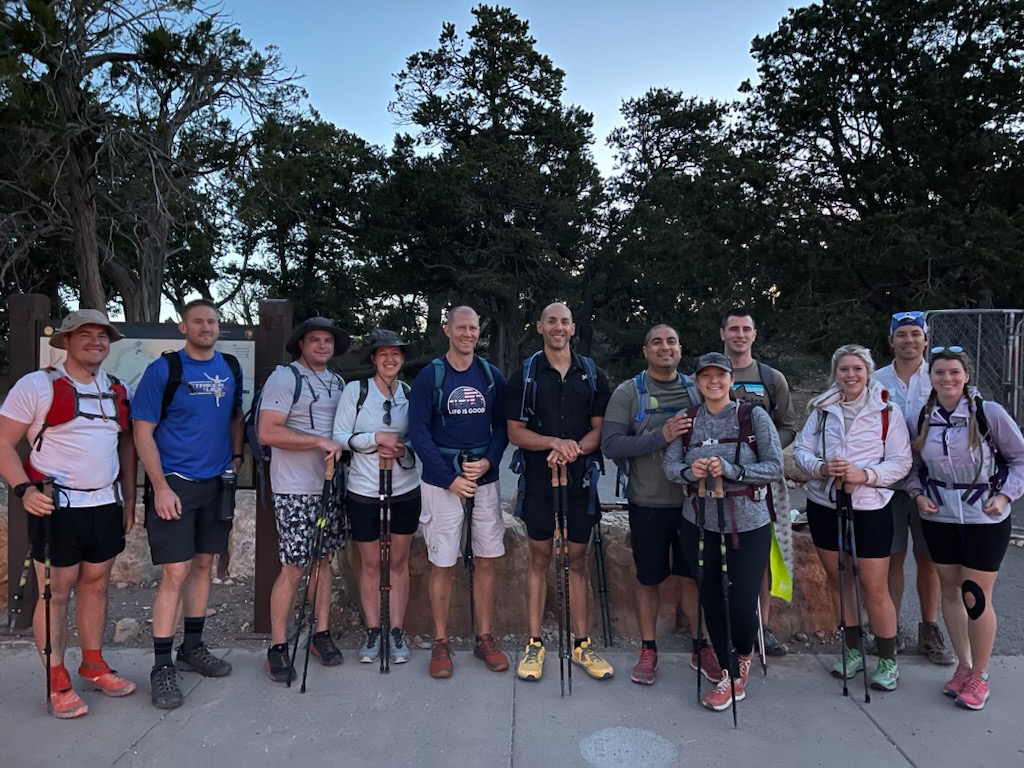
We only had about a 3.5 hour drive Thursday morning so I had time to get up early and log a short workout in the hotel gym. Wasn't great but wasn't bad either! Then, we all packed up, had a nice hot breakfast at the hotel then pushed off for our last section of highway. We met up with Mike and Lizzy at a local gas station in Ouray and after a short hello, had to make a decision about the weather. Our first trail was Imogene Pass which is the highest elevation trail we would do this weekend but there were dark clouds looming over the mountains. We decided to have a short lunch while we analyzed the weather; we knew we wouldn't have cell phone service again once we started the trail so we had to be certain before we started. We eventually decided that although it might rain, there shouldn't be any thunderstorms so we started off for the trailhead!
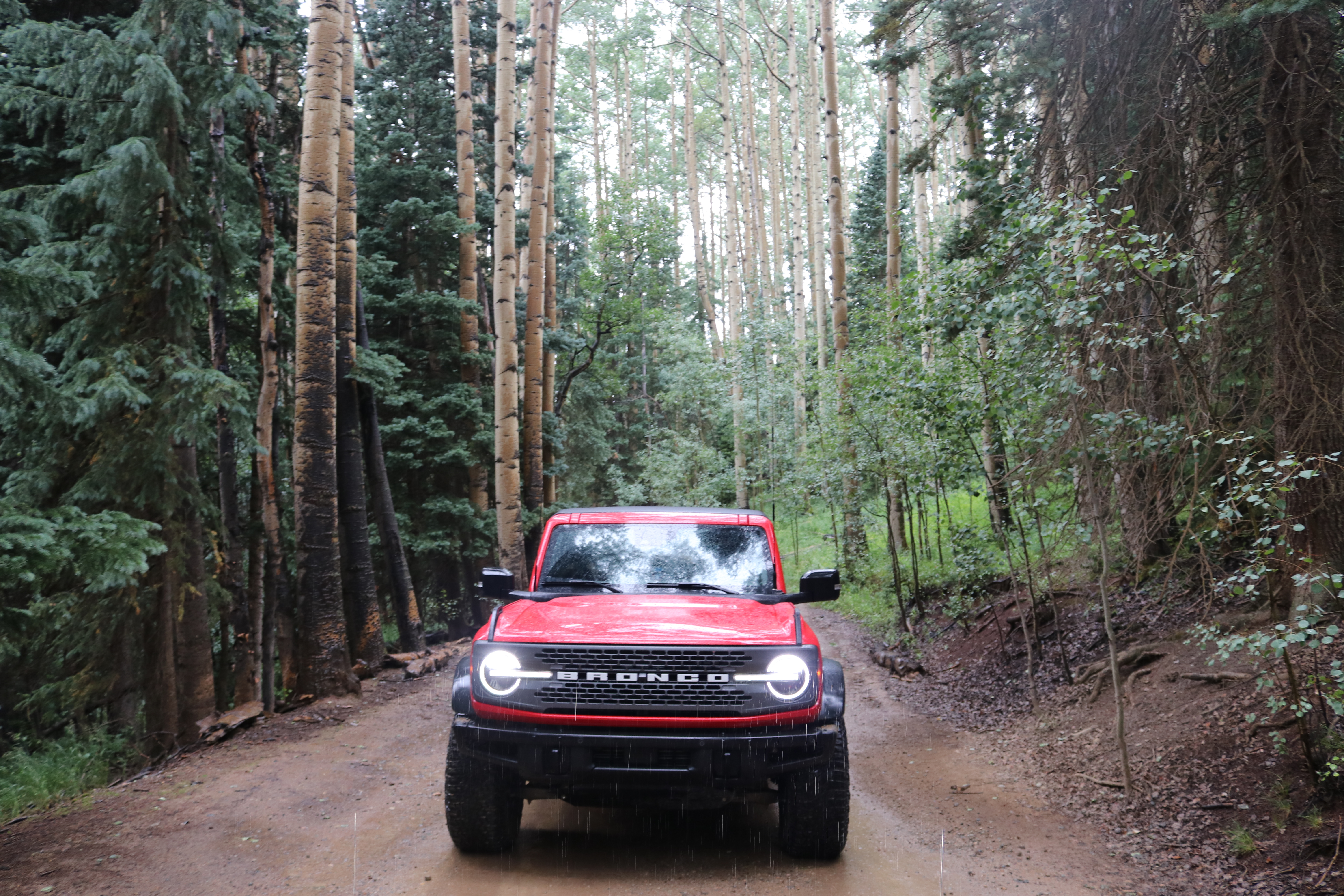
I planned to run the trail northeast to southwest so we would end next to Ophir Pass. Once we got to the trailhead and aired down, I instantly remembered why Imogene is one of my fav trails. The scenery is amazing! It starts going up through a forest with a few creek crossings before breaking out above the tree line for the final summit push. The difficulty of the forested section is pretty easy; however, the section above the tree line was a different story. There were a few times that I needed both the front and rear lockers to climb up a section but I feel that a vehicle not towing a trailer could do it without lockers on the appropriate line.
Once on the summit at 13,114 feet, the clouds started rolling back in. That would be the theme of the weekend. But, the clouds didn't block our view of the town of Telluride below and even Telluride airport, the highest commercial airport in North America, where I flew into a few months prior. Despite the questionable weather, the summit had a few other groups enjoying the trail as well so I had to wait in line to get a photo with the sign but it was worth the wait!
The backside of Imogene is less rocky and more cliffy. Although not difficult, I left the Bronco in 4WD Low to have better speed control especially with the trailer even though the trailer had brakes that were helpful once I got a little more accustomed to it. During the descent, we were in a scattered to few cloud layer. I didn't think much of it at the time but little do I know that this was nature's way of foreshadowing for the Alpine Loop that we would do the next day.
About halfway through the descent, we came across an old mining structure. This was not a surprise since most of these old trails were initially cut in for access to mines. Although it wasn't in good shape anymore, we stopped briefly to take a look.
Near the end of the trail, Imogene offers a good vantage of Black Bear Pass which is nearby. Nina and I had done this trail the day I proposed years before but it was closed this time so we weren't able to do it.
Once we finished Imogene, I realized it took us a little longer than expected. Although the plan was to do Ophir Pass that day as well, I didn't want to risk being high altitude in the rain as the sun was setting. So, we decided to change the plan and camp at a local camp site in town called Mary E Campground. We talked with the campground host and he gave us two sites tucked back in the woods that was remote enough that we didn't see or hear anyone else. Perfect! Until it started raining all night....
Day 2 - Friday
We woke up rested on Friday ready for a full day of wheeling. After a short breakfast, we packed up and headed to Ophir Pass. We took the pass west to east so we would end up near Silverton which was the next trail that we had planned.
Ophir Pass started with us driving through the town of Ophir which is well off the beaten path. The town was very quaint and had many signs preventing the use of RZRs or side by sides. That was great news for us because that meant they weren't allowed on the trail either. The trail started driving through a forest before it eventually opened up into a big clearing and turned into a shelf road as we continued towards the summit.
As we summited at 11,789 feet, we had a good view of the trail going into the town of Silverton. This pass was short enough that it's actually about the same duration to go over the pass than it would be to take the highway which is helpful since that's where we were trying to go anyways. The terrain was fairly easy and only needed 2WD but high clearance always helps. Obviously, this way was more scenic!
After Ophir Pass, Mike wanted to hit the gas station in Silverton so we made a short pit stop. It wasn't quite lunch time yet, but we all bought $5 gas station microwavable pizzas to tide us over.
Once our hungers were satisfied, we started the Animas Fork western portion of the loop that connects to the Alpine Loop. Of course, it immediately started raining once we were on the trail but that didn't slow us down!
Not long into the trail, we stopped at the Animas Forks Mining Historic Site. This was really cool since the Bureau of Land Management upkeeps the eight houses in the historic site so we could walk in them and get a feel for how the mining town actually looked in the late 1800's. This is a stark contrast from most mining towns I've come across that have all the windows blown out and are unsafe to enter.
We broke for lunch while at the site which gave us all time to walk around and take it all in. Mike and Lizzy were able to get the dogs out of the truck and walk around too. They seemed to like it! We also had a discussion about changing our day plan since we were running late. Shaun knew a decent camp area on the western side of the trail, so we decided to run Alpine Loop from the South counterclockwise and exit on the western side and skip the 2nd half of Animas Forks.
After Animas Forks, it was time to start the Alpine Loop! Our first ascent would be towards Cinnamon Pass. This was a trail that I haven't done before but both Mike and Shaun said they had. Despite that, Bruce and Shelly were out in front leading the pack! The climb leading up to Cinnamon pass wasn't difficult and we got up there pretty quick. It wasn't raining and the clouds were more of a scattered to broken layer which gave us great views of the surrounding area. Pa and I had to grab a selfie, of course!

Next up was Engineer Pass. It was about 50 miles of excellent Colorado scenery between the two passes. Totally worth the long drive out to this area! Once we arrived at the final push to the summit for Engineer Pass, we started to notice the clouds were thickening. Once we summitted, we were in an overcast layer and visibility dropped to only about 50 feet. The section of trail after the summit followed the ridgeline on a shelf road that was quite narrow - a bit eerie to drive on when you can't see over the edge!
To complete the otherworldly experience, Pa and I started hearing bells ringing close by but couldn't see far enough through the cloud to identify the source. Around that time, Shaun radioed that he saw sheep up ahead. Pa and I never saw them but we sure did hear them! I was driving less than 5 MPH so we weren't going to hit them unexpectedly. At one point, I looked at Pa and we noticed that there was a small puff of cloud actually inside the car, very surreal! It was too small to get a photo of, but it was there, trust me, I saw it.
After the uncanny section, we started descending out of the cloud layer and were able to see a bit more. This was helpful since the backside of the summit was mostly switchbacks. By the end of this trip, I was a pro at using the Bronco's trail turn assist to help make these tight switchbacks with the trailer. It also helped that the trailer is equipped with a fully articulating hitch so there was no limit on how tight of a turn I could make. There were a few times that I had to reverse and the 12-foot-long trailer would jackknife quickly.
The bottom of the switchbacks opened up into a beautiful meadow. Although there was an abundance of flowers, we were still above the tree line so there were no trees. It was a pretty cool sight to see up at 12,000 feet. After the meadow, we exited off of the Alpine Loop to the west side towards a camping spot for the night putting us in better position the next morning to be closer to the trailhead for RimRocker. We put a lot of mileage down that day so I think we were all ready for camp especially the fluffy huskies.
Shaun led us to a great camp site right by a creek in a forested area although it was a hard fought for spot down an hour-long rough trail. This spot was great since the trees kept the light drizzle from hitting the ground and broke the wind before hitting our tents. While the rest of us were getting the fire going, Mike pulled a classic Mike move and took a bath in the nearby river. I'm sure it was close to freezing but that didn't stop him! After dinner, we all hung out, drank for a bit, and talked about how crazy coming across a flock of sheep on the side of a mountain was. We called it an early night with some more miles to go in the morning. Day 3 - Saturday
Saturday started as a sunny day with clear skies as we packed up camp and headed out. We drove through Ouray to Montrose for gas before jumping on the RimRocker trailhead. We started the trail around 11am and knew we had some miles to go. Since we were all driving home the next day, we wanted to camp as far into the trail as we could to minimize the time on the trail the following day.
We were hopeful for a quick trail as the first 1/4 of the trail was fast. Like 40mph fast. We made great time! So about an hour in, we stopped for lunch thinking that we would make it through most of the trail in one day if the speed kept up. There was a turn off with a large enough area for parking called Tabequache overlook. Pa and I broke out the signature PBJ and had a nice lunch overlooking the valley below us. I grabbed a great photo of Pa reflecting on the scene while enjoying his sammie. After lunch, the trail took us down into the valley that we were looking at just minutes before. As we descended, we were quickly reminded that we were no longer above 10,000 feet as the temperature steadily rose as we steadily descended. It gave me an opportunity to break out my new solar powered fan hat which was a big hit with the group and kept my head cool!
This 160-mile trail was originally put together in 2016 by a collaborative effort between the Bureau of Land Management and National Park Service and spans two states. It is a collection of multiple trails and a few miles of road that go through some of the local towns. So, after the fast 40 miles, we drove through the town of Nucla. After Nucla, the trail took us up on a ridge overlooking the highway below. When the trail was originally cut in, it was decades before the highway was created.
A little passed halfway, we stopped for camp at the Buckeye Campground. This campground surrounds a huge lake completely isolated from any nearby town. Despite the downpour that started once we pulled in and a few other folks camping, we got a great spot right along the lakeshore. I put on my rain gear and set up camp right as the weather broke so we could make dinner. After dinner, we burned the rest of our firewood and just hung out enjoying the great scenery.
Day 4 - Sunday
We woke up Sunday morning to clearer skies and no rain - a pleasant change from the previous few days. After packing up, Mike and Lizzy decided to punch off the trail a bit early and start tackling the long drive back. So, we said our goodbyes as they turned towards the exit while Shaun, Pa and I continued on the 2nd half of the RimRocker. Not long into the day, the three of us decided that Mike and Lizzy had made the better choice as this portion of the trail was washed out and very bumpy.
Although, I was glad we gutted it out (literally) because we came across the state line between Utah and Colorado. This reminded me of the Hoover Dam that had a similar sign depicting the difference between Arizona and Nevada. It was cool to see so we stopped to take a photo.
After the sign, we kept pushing on and were able to finish a little before lunch time. We aired up in Moab and I gave a once over inspection of the trailer since this was Shelly's first big trip and am happy to report that nothing broke! The trailer held together like a champ despite many bumps in the road and even got airborne a few times. Super impressed! We started for home hoping to make it before it was too late.
After stopping for gas in Beaver, we arrived back in the Vegas area around 6PM. Not bad! Pa and I elected to just go straight to the car wash and give everything an initial spray. Shaun decided to join. After parting ways with our somewhat clean vehicles, Pa and I were home and unpacked, showered and had pizza delivered from Chicago Pizza Guys for a chill night at home. Pa initially intended to fly out the next day but some weather delayed him for a day or two so we got to spend a few extra days with Pa. Even though I had to work, Pa cleaned out the trailer real good which I appreciated.
However, no one appreciated having stay at home company more than our fluffy boy who didn't get to come on the trip. Overall, it was a great trip and I was glad we could get the group together to carve out a weekend to go! Big takeaways: more time in Colorado, maybe skip the second half of RimRocker, and definitely go back to Buckeye campground.
Files: